


Map galore!
"Reading" the Yamanote Line through maps

Dear readers, I don’t know you, but I love maps. I can spend hours studying them. Maps, diagrams, etc. they all help us know a place without the need of too many words. So, let’s have a look.
***** Sorry for the far-from-perfect quality of same of the images
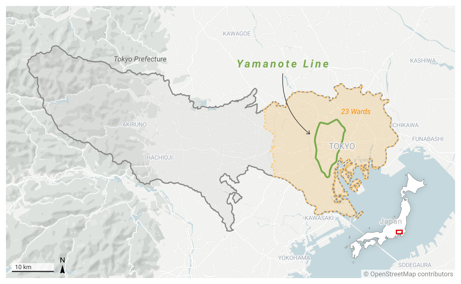
The map above shows the Yamanote Line’s position inside Tokyo. The 23-ward central area represents what until 1943 was Tokyo City. The “city” as an administrative entity was abolished in that year and replaced by the Tokyo Metropolis - Tokyo-to in Japanese (in the map, it’s called Tokyo Prefecture) which comprises the old city plus the western suburbs.
Therefore, technically speaking, the city of Tokyo does not exist anymore
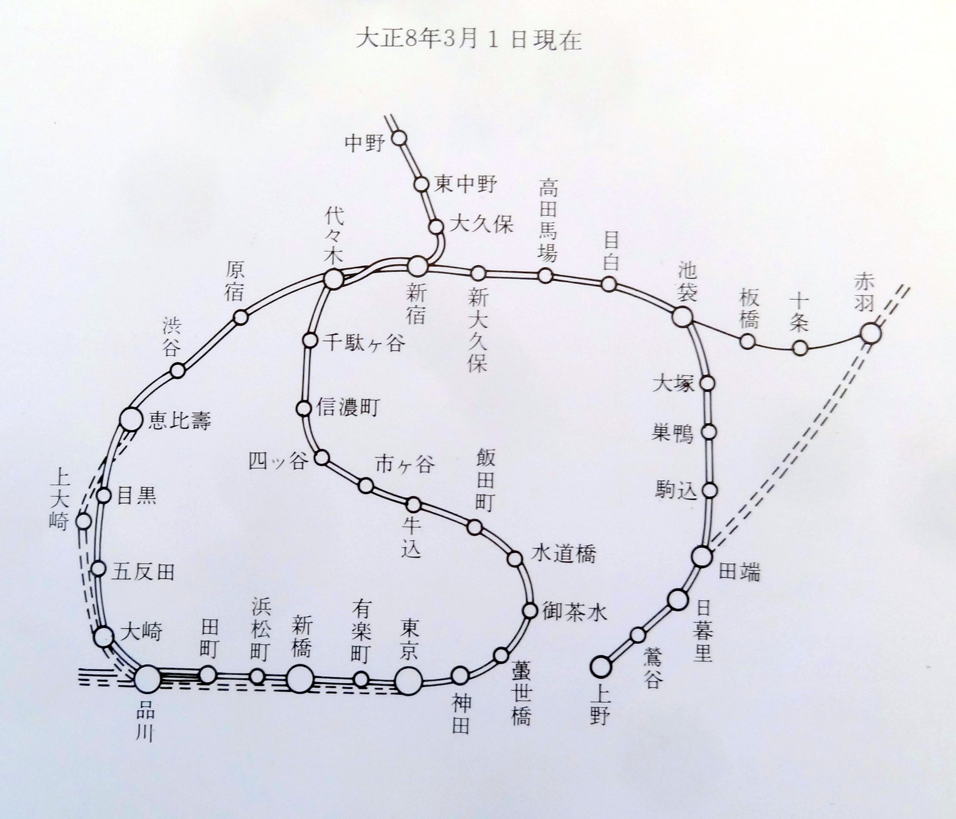
As I explained in the introduction to this project, the Yamanote Line was developed in stages, gradually extending its tracks and adding new stations (Shinagawa, Shibuya, and Shinjuku were three of the five original stations). The map above is from 1919, when the loop was not completed yet. By the way, the orientation is “wrong”: the north is one the right side of the map, the west is on top. I guess it was oriented this way to show the line’s “no” design, so called because it’s similar to the Japanese syllable の, which is pronounced “no.”
***** The S-shaped bit in the middle is a different line.
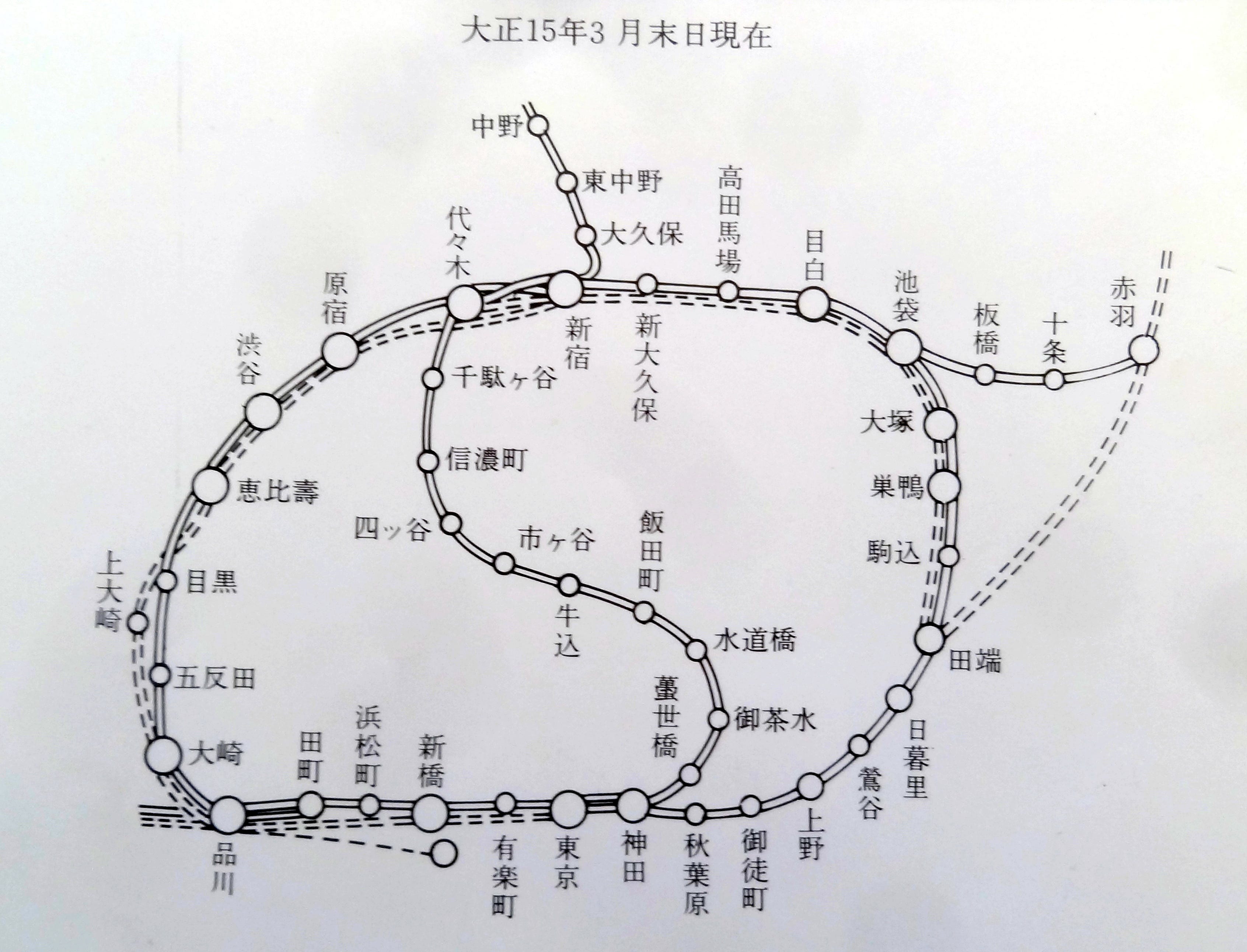
This map is from March 1926. By that time the last gap had been closed. In fact, the loop was completed in November 1925.
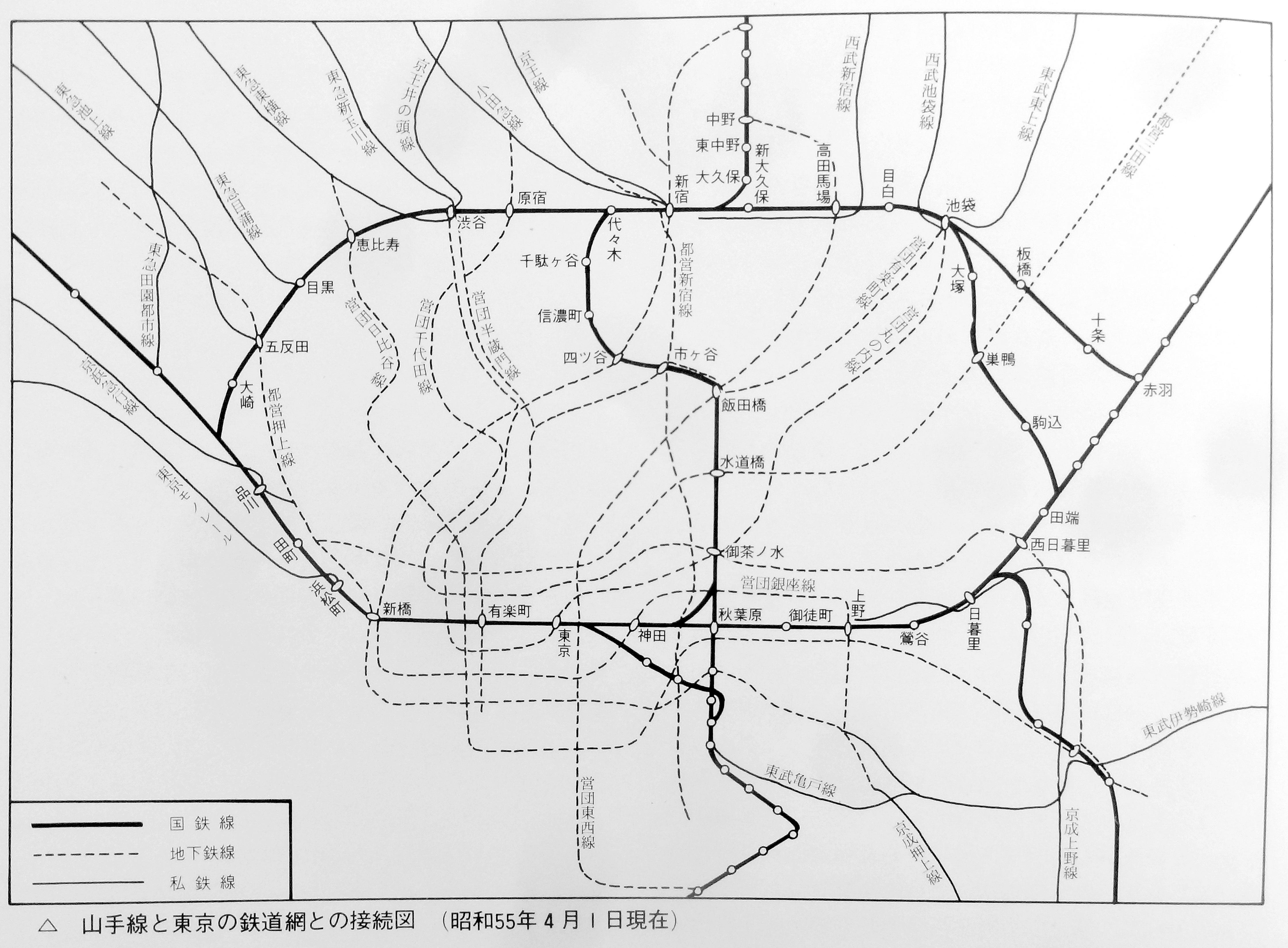
This map is from 1980 and shows all the private railway lines (solid lines) branching out like spokes from the Yamanote Line, and the subway system (dashed lines) inside the loop.
Keep reading with a 7-day free trial
Subscribe to Tokyo Calling to keep reading this post and get 7 days of free access to the full post archives.